
Mountain mapping with our custom Hexacopter.
/Today a guest post by our head pilot, Marcus See, about his recent experience flying our newly built custom compact hexacopter, to map a portion of Cameron highlands, Malaysia.
By: Marcus
A first for us, flying our drone high in the clouds of Cameron Highlands. Approximately 5,000 feet above mean sea level (AMSL), with a mean temperature of 18 to 25, humidity levels of 80% and winds as high as 20km/h. A weather condition very much different from Singapore.
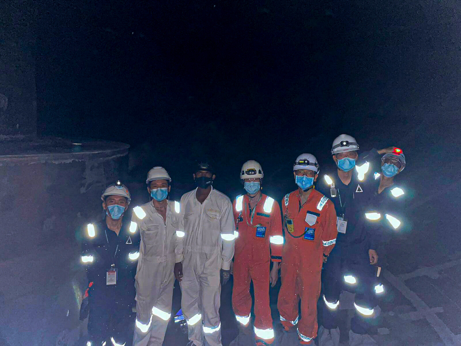
So what are we doing in Cameron Highlands? Our mission was to map an area 1km by 1km in the heart of the tea mountains, together with our counterparts from Malaysia, Avetics Malaysia (managed by Sanudra Aerial Solutions Sdn Bhd), with a secondary task to capture thermal data.
We brought our newly built custom Mini Hex for the challenge, against the tropical highland climate.

Our pilot Youzhi operating the Mini Hex, our custom-made platform.
Tanah Rata was our area of operations. This was a tricky area to map, the town consists of tropical forest, tea plantations, farmlands and many facilities and amenities. Located amidst the highland region with an elevation of 4,720 feet.
First task on our list was a routine test flight, we also wanted to test the range of the Mini Hex as we could never get vast amount of open land like this in Singapore. We were like proverbial city boys in the countryside.
The outcome was good, we slowly pushed the drone further and further away from us - further than eyes could maintain Visual Line of Sight (VLOS). It was a new experience for us, to be able to push the drone to its limits and not having to worry about flying over people’s property, invading privacy, or worrying about obstacles.

Our Mini-Hex
With a successful test, we were confident executing the actual mission. But, we still had one more challenge to overcome. Locating a good connection for our data to be sent back to Singapore for processing. It’ll be a useless flight unless we had the data. On the hill, it was tricky finding a data connection at all!. Thankfully, cellular data pulled through.
D-Day, we found a pretty good vantage point to take-off, the rooftop of the bus terminal. It was rather foggy but that’s about the best you can get from a place 5,000 ft up.
Everything went according to plan, no mishaps and even no loss of video feed while mapping! With the flight done, it was time to process the data of Tanah Rata.
The data produced was good, a few things we could improve on but overall, the results was a success.
Some observations for possible mapping improvements noted was:
1) Integration of the topographical map with the mission planning.
2) Thermal mapping would be an interesting idea to explore.
3) Implementing a portable data processing platform, to increase processing time.
The end of the day we gained experience we couldn’t have in Singapore’s terrain, learnt from our Malaysian counterparts how different the expectations are in the drone industry in Locally.
Time to head home
*Mini Hex Specifications:
Max take-off weight: 5.5kg
Endurance: 40minutes flight time (without payload)
Max ascent speed: 4m/s
Max descent speed: 3m/s
Max speed: 16m/s
Max wind resistance: 10m/s
Max altitude: 500m AGL
Operating Frequency: 2.400 – 2.483 GHz, 5.725 – 5.850 GHz
Max transmitting distance (unobstructed, free of interference): 2.4 GHz: 5km, FCC 5.8 GHz: 5km, FCC